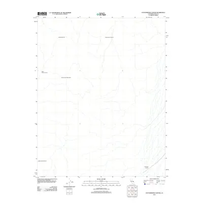
2012 Map of Cottonwood Canyon
USGS Topo · Published 2012About this map
The Cottonwood Mountains dominate this high-elevation Inyo County landscape, defined by a complex network of deep drainage systems that feed toward the valley floor. In the early twenty-first century, these desert corridors remained largely inaccessible, shaped by seasonal water flow rather than human development. The map follows the extensive path of Cottonwood Canyon as it winds through the central and southern reaches, joined by tributary drainages such as Dead Horse Canyon. To the north, Marble Canyon cuts through the high terrain, while Lemoigne Canyon occupies the southeastern corner. This survey documents the raw topography of the Great Basin, where the lack of roads and settlements emphasizes the primitive state of this protected California wilderness.
Find a feature on this map
5 named features on this map. Tap any name to fly to it.
Don’t see what you’re looking for? This feature index may not catch every label — zoom into the map to look around manually.
Map Details
Editions of this 2012 Cottonwood Canyon Map
This is the sole edition of this map. No revisions or reprints were ever made.
Other maps of this area

1908 · Ballarat
USGS Topo · 1:250,000

1913 · Ballarat
USGS Topo · 1:250,000

1948 · Death Valley
USGS Topo · 1:250,000

1951 · Panamint Butte
USGS Topo · 1:62,500

1951 · Marble Canyon
USGS Topo · 1:62,500

1952 · Stovepipe Wells
USGS Topo · 1:62,500

1952 · Emigrant Canyon
USGS Topo · 1:62,500

1954 · Death Valley
USGS Topo · 1:250,000

1956 · Death Valley
USGS Topo · 1:250,000

1957 · Death Valley
USGS Topo · 1:250,000