
1951 Map of Marble Canyon
USGS Topo · Published 1952About this map
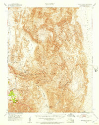
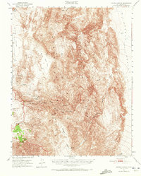
Death Valley National Monument reveals a complex landscape of vertical relief and early industrial activity during the mid-twentieth century. The territory is dominated by the Panamint Mountains, where the elevation drops sharply into the Death Valley and Hidden Valley depressions. This era of land use is characterized by the presence of isolated mining operations and essential water sources, such as the Ubehebe Talc Mine, Keeler Mine, and Goldbelt Spring. The mapping of Petroglyphs near Sand Flat indicates a long history of human presence in this arid environment. Transportation at this time was limited to a network of Jeep Trails and standard trails, following the natural contours of major geological features like Cottonwood Canyon and Dead Horse Canyon.
Find a feature on this map
24 named features on this map. Tap any name to fly to it.
Don’t see what you’re looking for? This feature index may not catch every label — zoom into the map to look around manually.
Map Details
Editions of this 1951 Marble Canyon Map
3 editions found
Other maps of this area

1908 · Ballarat
USGS Topo · 1:250,000

1913 · Ballarat
USGS Topo · 1:250,000

1948 · Death Valley
USGS Topo · 1:250,000

1950 · Darwin
USGS Topo · 1:62,500

1950 · Ubehebe Peak
USGS Topo · 1:62,500

1951 · Darwin
USGS Topo · 1:62,500

1951 · Ubehebe Peak
USGS Topo · 1:62,500

1951 · Panamint Butte
USGS Topo · 1:62,500

1952 · Stovepipe Wells
USGS Topo · 1:62,500

1952 · Emigrant Canyon
USGS Topo · 1:62,500