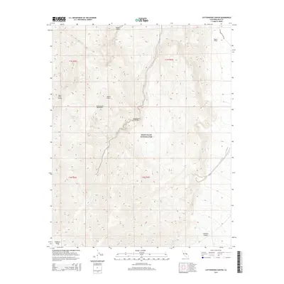
2015 Map of Cottonwood Canyon
USGS Topo · Published 2015About this map
Death Valley National Park encompasses this high-elevation desert landscape, where the Cottonwood Mountains and the northern reaches of the Panamint Range dominate the topography. The map illustrates a complex drainage system of deep washes and alluvial fans, centered on the primary thoroughfare of Cottonwood Canyon. To the northeast, the terrain drops toward the floor of Death Valley, while Marble Canyon cuts through the northern heights.
Find a feature on this map
14 named features on this map. Tap any name to fly to it.
Don’t see what you’re looking for? This feature index may not catch every label — zoom into the map to look around manually.
Map Details
Editions of this 2015 Cottonwood Canyon Map
This is the sole edition of this map. No revisions or reprints were ever made.
Other maps of this area

1908 · Ballarat
USGS Topo · 1:250,000

1913 · Ballarat
USGS Topo · 1:250,000

1948 · Death Valley
USGS Topo · 1:250,000

1951 · Panamint Butte
USGS Topo · 1:62,500

1951 · Marble Canyon
USGS Topo · 1:62,500

1952 · Stovepipe Wells
USGS Topo · 1:62,500

1952 · Emigrant Canyon
USGS Topo · 1:62,500

1954 · Death Valley
USGS Topo · 1:250,000

1956 · Death Valley
USGS Topo · 1:250,000

1957 · Death Valley
USGS Topo · 1:250,000