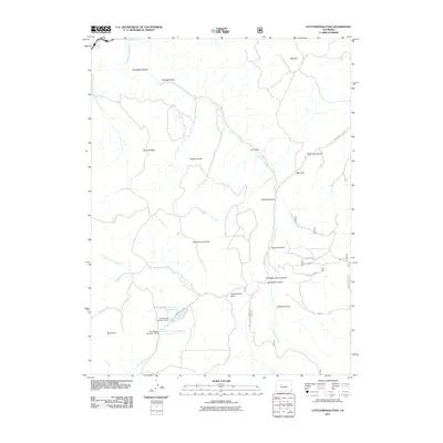
2011 Map of Cottonwood Pass
USGS Topo · Published 2011About this map
Cottonwood Pass and the high ridge of the Cottonwood Divide anchor this high-elevation landscape in Garfield County. The drainage network is defined by numerous gulches and creeks, including Sawmill Gulch, Fitzpatrick Gulch, and the winding Cottonwood Creek which flows toward the Colorado River in the northwest. Water management is a central feature of the southern terrain, where Von Springs Reservoir Number 1 and Von Springs Reservoir Number 2 are held by their respective dams. The map illustrates a network of mountain transit routes such as the Cottonwood Pass Rd and Red Table Mountain Rd, providing access to distinct landmarks like The Eagle Nest and Gobbler Knob. These features suggest a landscape utilized for water storage and seasonal transit through the high country.
Find a feature on this map
35 named features on this map. Tap any name to fly to it.
Don’t see what you’re looking for? This feature index may not catch every label — zoom into the map to look around manually.
Map Details
Editions of this 2011 Cottonwood Pass Map
This is the sole edition of this map. No revisions or reprints were ever made.
Other maps of this area

1909 · Mount Jackson
USGS Topo · 1:125,000

1911 · Mount Jackson
USGS Topo · 1:125,000

1927 · Glenwood Springs
USGS Topo · 1:125,000

1930 · Glenwood Springs
USGS Topo · 1:125,000

1957 · Leadville
USGS Topo · 1:250,000

1959 · Leadville
USGS Topo · 1:250,000

1960 · Leadville
USGS Topo · 1:250,000

1961 · Carbondale
USGS Topo · 1:24,000

1961 · Leon
USGS Topo · 1:24,000

1961 · Cottonwood Pass
USGS Topo · 1:24,000