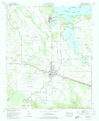
1974 Map of Courtland
USGS Topo · Published 1975About this map
Courtland and its surrounding agricultural landscape are documented in this mid-1970s revision, which highlights the intersection of historic river crossings and modern infrastructure. The Tennessee River and Wheeler Lake dominate the northern boundary, where legacy river features like Egypt Ford and Brickhouse Ford contrast with the large industrial footprint of a water filtration plant and purification ponds. South of the main town, the vast Courtland Air Base (abandoned) remains a prominent landmark, its runways still visible decades after its military utility peaked. The map is particularly rich in genealogical data, preserving the locations of numerous family and church burial grounds such as the Andrew Garth Memorial Cem, Sherrod Cem, and Byrd Cem. Settlement patterns like Sherrod Quarters and the residential expansion of Terry Heights illustrate the evolving social geography of Lawrence County.
Find a feature on this map
65 named features on this map. Tap any name to fly to it.
Don’t see what you’re looking for? This feature index may not catch every label — zoom into the map to look around manually.
Map Details
Editions of this 1974 Courtland Map
This is the sole edition of this map. No revisions or reprints were ever made.
Other maps of this area

1914 · Rogersville
USGS Topo · 1:48,000

1916 · Rogersville
USGS Topo · 1:62,500

1936 · Caddo
USGS Topo · 1:24,000

1936 · Thorntontown
USGS Topo · 1:24,000

1936 · Courtland
USGS Topo · 1:24,000

1936 · Hillsboro
USGS Topo · 1:24,000

1936 · Wheeler Dam
USGS Topo · 1:24,000

1936 · Town Creek
USGS Topo · 1:24,000

1936 · Cairo
USGS Topo · 1:24,000

1936 · Masterson
USGS Topo · 1:24,000