Loading...
Loading map...2024 Map of Covington
USGS Topo · Published 2024About this map
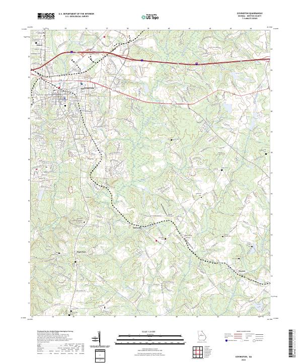
Covington and the neighboring college town of Oxford anchor this detailed study of central Newton County. The landscape is defined by the winding course of the Alcovy River, which flows southward alongside numerous tributaries including Dried Indian Creek and Cornish Creek. The map provides a high level of detail for local history and genealogy, noting several significant burial grounds such as the Confederate Soldiers Cem and Covington City Cem.
Find a feature on this map
155 named features on this map. Tap any name to fly to it.
Don’t see what you’re looking for? This feature index may not catch every label — zoom into the map to look around manually.
Map Details
Date Portrayed2024
Date Published2024
PublisherU.S. Geological Survey
Map TypeTopographic
Scale1:24000
Physical Dimensions24 x 29 inches
Editions of this 2024 Covington Map
This is the sole edition of this map. No revisions or reprints were ever made.
Historical Maps of Jamestown Through Time
Featured Locations
Source Details
SourceU.S. Geological Survey
CopyrightPublic Domain