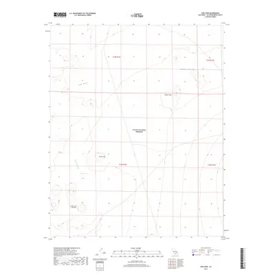
2018 Map of Cow Cove
USGS Topo · Published 2018About this map
Mojave National Preserve encompasses most of this high-desert landscape in San Bernardino County, where volcanic history is written across the terrain in the Cinder Cone Lava Beds. This area of the Mojave Desert is characterized by broad basins like Shadow Valley and isolated peaks such as Button Mtn. The hydrology is defined by seasonal drainage patterns, most notably Black Tank Wash, which leads toward the Black Tank water feature. The map provides a detailed view of the natural amphitheater of Cow Cove and the surrounding township and range survey lines. This 2018 topographic study reflects the modern boundaries of the national preserve, illustrating the transition between open desert valleys and concentrated volcanic formations that have shaped the region's geological character.
Find a feature on this map
12 named features on this map. Tap any name to fly to it.
Don’t see what you’re looking for? This feature index may not catch every label — zoom into the map to look around manually.
Map Details
Editions of this 2018 Cow Cove Map
This is the sole edition of this map. No revisions or reprints were ever made.
Other maps of this area

1910 · Ivanpah
USGS Topo · 1:250,000

1912 · Ivanpah
USGS Topo · 1:250,000

1942 · Ivanpah
USGS Topo · 1:250,000

1947 · Kingman
USGS Topo · 1:250,000

1948 · Kingman
USGS Topo · 1:250,000

1954 · Kingman
USGS Topo · 1:250,000

1955 · Kingman
USGS Topo · 1:250,000

1955 · Mescal Range
USGS Topo · 1:62,500

1955 · Kelso
USGS Topo · 1:62,500

1956 · Halloran Spring
USGS Topo · 1:62,500