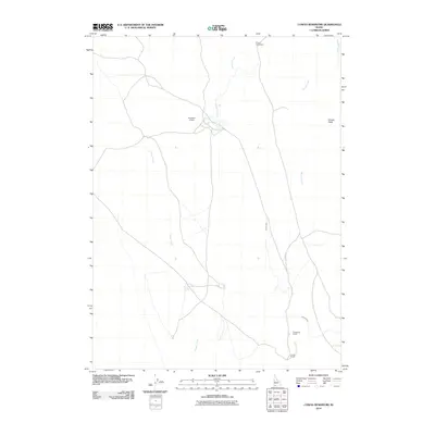
2010 Map of Cowan Reservoir
USGS Topo · Published 2010About this map
Cowan Homestead and established ranching outposts define this high-desert landscape in Owyhee County, Idaho. The map reveals a sophisticated network of water management essential for livestock and settlement in the arid West, centered around the Diamond A Dam and the long, winding path of the Cowan Ditch. These man-made improvements work in concert with natural drainage systems like Cougar Creek and Dorsey Creek to sustain the local geography. Significant landforms such as Dorsey Table overlook the valley, providing natural landmarks for the Rutherford Ranch and Jones Ranch. This 2010 survey offers a detailed record of remote Idaho land use, showing how family names remain etched onto the map through homesteads and ranching properties that have persisted through the generations.
Find a feature on this map
8 named features on this map. Tap any name to fly to it.
Don’t see what you’re looking for? This feature index may not catch every label — zoom into the map to look around manually.
Map Details
Editions of this 2010 Cowan Reservoir Map
This is the sole edition of this map. No revisions or reprints were ever made.
Other maps of this area

1936 · Rowland
USGS Topo · 1:48,000

1940 · Rowland
USGS Topo · 1:62,500

1943 · Jarbidge
USGS Topo · 1:62,500

1945 · Jarbidge
USGS Topo · 1:62,500

1955 · Twin Falls
USGS Topo · 1:250,000

1955 · Wells
USGS Topo · 1:250,000

1958 · Wells
USGS Topo · 1:250,000

1958 · Twin Falls
USGS Topo · 1:250,000

1961 · Wells
USGS Topo · 1:250,000

1978 · The Arch
USGS Topo · 1:24,000