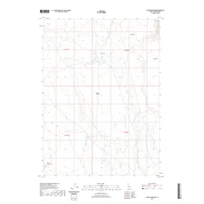
2020 Map of Cowan Reservoir
USGS Topo · Published 2020About this map
Cowan Reservoir and the surrounding high plateau of Owyhee County define this landscape of the modern American West. This high-altitude desert environment is shaped by essential water sources and distinct landforms such as Arch Canyon and the massive Diamond A Desert. The map reveals a reliance on isolated water points, including Dead Horse Spring, Willow Spring, and Gardner Spring, which are critical in a region where surface water is scarce. Human engineering is visible through the Cowan Ditch, which redirects flow from Cougar Cr toward the reservoir. Geologic features like the Arch Table and Dorsey Table provide clear markers of the flat-topped mesas characteristic of the region, while the curiously named Hole in the Ground suggests localized topographical depressions in the southwest corner.
Find a feature on this map
16 named features on this map. Tap any name to fly to it.
Don’t see what you’re looking for? This feature index may not catch every label — zoom into the map to look around manually.
Map Details
Editions of this 2020 Cowan Reservoir Map
This is the sole edition of this map. No revisions or reprints were ever made.
Other maps of this area

1936 · Rowland
USGS Topo · 1:48,000

1940 · Rowland
USGS Topo · 1:62,500

1943 · Jarbidge
USGS Topo · 1:62,500

1945 · Jarbidge
USGS Topo · 1:62,500

1955 · Twin Falls
USGS Topo · 1:250,000

1955 · Wells
USGS Topo · 1:250,000

1958 · Wells
USGS Topo · 1:250,000

1958 · Twin Falls
USGS Topo · 1:250,000

1961 · Wells
USGS Topo · 1:250,000

1978 · The Arch
USGS Topo · 1:24,000