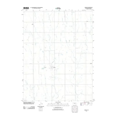
2011 Map of Cowles
USGS Topo · Published 2011About this map
The village of Cowles sits at the heart of this Webster County landscape, defined by the intricate branching of Elm Creek and its many tributaries. The area is characterized by a high concentration of burial grounds, including the Batin Cemetery to the northwest, Salem Cemetery to the northeast, and Mulkey Cemetery on the eastern edge. These sites serve as critical anchors for genealogical research in this rural Nebraska township. Water management is evident south of the village center, where the Gestring Dam and Gestring Reservoir collect flow from the surrounding prairie. Significant natural drainage systems such as Willow Creek, Dry Creek, and Beaver Creek carve through the section lines, illustrating the agricultural irrigation and natural geography of the region in the early 21st century.
Find a feature on this map
16 named features on this map. Tap any name to fly to it.
Don’t see what you’re looking for? This feature index may not catch every label — zoom into the map to look around manually.
Map Details
Editions of this 2011 Cowles Map
This is the sole edition of this map. No revisions or reprints were ever made.
Other maps of this area

1897 · Red Cloud
USGS Topo · 1:125,000

1898 · Superior
USGS Topo · 1:125,000

1940 · Red Cloud
USGS Topo · 1:62,500

1942 · Red Cloud
USGS Topo · 1:62,500

1955 · Grand Island
USGS Topo · 1:250,000

1957 · Grand Island
USGS Topo · 1:250,000

1958 · Grand Island
USGS Topo · 1:250,000

1969 · Lawrence
USGS Topo · 1:24,000

1969 · Blue Hill
USGS Topo · 1:24,000
1969 · Bladen
USGS Topo · 1:24,000