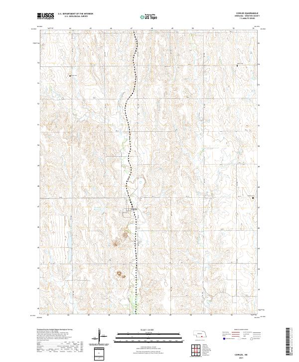
2021 Map of Cowles
USGS Topo · Published 2021About this map
The village of Cowles sits at the intersection of 1st St and Harlan St, serving as a central point in this southern Nebraska agricultural landscape. The surrounding terrain is defined by a dendritic drainage pattern where several branches of Elm Creek, including W Fork Elm Creek and E Fork Elm Creek, carve through the rolling sections of Webster County. Water management is evident at Gestring Reservoir, while smaller streams like Willow Creek and Beaver Creek wind through the township boundaries of t3n r10w and t3n r9w.
Find a feature on this map
28 named features on this map. Tap any name to fly to it.
Don’t see what you’re looking for? This feature index may not catch every label — zoom into the map to look around manually.
Map Details
Editions of this 2021 Cowles Map
This is the sole edition of this map. No revisions or reprints were ever made.
Other maps of this area

1897 · Red Cloud
USGS Topo · 1:125,000

1898 · Superior
USGS Topo · 1:125,000

1940 · Red Cloud
USGS Topo · 1:62,500

1942 · Red Cloud
USGS Topo · 1:62,500

1955 · Grand Island
USGS Topo · 1:250,000

1957 · Grand Island
USGS Topo · 1:250,000

1958 · Grand Island
USGS Topo · 1:250,000

1969 · Lawrence
USGS Topo · 1:24,000

1969 · Blue Hill
USGS Topo · 1:24,000
1969 · Bladen
USGS Topo · 1:24,000