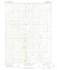
1974 Map of Cowles
USGS Topo · Published 1977About this map
The village of Cowles serves as the central hub for this Webster County agricultural landscape during the mid-1970s. Situated along the Burlington Northern railroad line, the town is surrounded by a network of drainage systems including the West Fork and East Fork Elm Creek, as well as Willow Creek and Beaver Creek. The map provides specific locations for local family and community landmarks, particularly through its documentation of three distinct burial grounds: Batin Cem, Salem Cem, and Mulkey Cem. Industrial activity is noted by a Gravel Pit and a prominent Radio Tower to the south. The prevalence of numerous marked Wells across the survey area underscores the importance of groundwater management for the surrounding farms and homesteads in this part of southern Nebraska.
Find a feature on this map
12 named features on this map. Tap any name to fly to it.
Don’t see what you’re looking for? This feature index may not catch every label — zoom into the map to look around manually.
Map Details
Editions of this 1974 Cowles Map
This is the sole edition of this map. No revisions or reprints were ever made.
Other maps of this area

1897 · Red Cloud
USGS Topo · 1:125,000

1898 · Superior
USGS Topo · 1:125,000

1940 · Red Cloud
USGS Topo · 1:62,500

1942 · Red Cloud
USGS Topo · 1:62,500

1955 · Grand Island
USGS Topo · 1:250,000

1957 · Grand Island
USGS Topo · 1:250,000

1958 · Grand Island
USGS Topo · 1:250,000

1969 · Lawrence
USGS Topo · 1:24,000

1969 · Blue Hill
USGS Topo · 1:24,000
1969 · Bladen
USGS Topo · 1:24,000