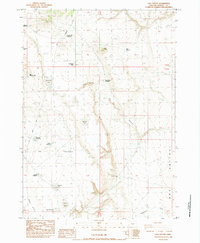
1984 Map of Cox Canyon
USGS Topo · Published 1984About this map
Emteker Homestead stands as a solitary named residence in this high desert landscape of Harney County, mapped during the early 1980s. The terrain is defined by its reliance on water management, evidenced by numerous man-made and natural catchments including South Draw Reservoir, Kiely Reservoir, and Rehab Reservoir. The naming conventions throughout the quadrangle suggest a history of ranching and livestock movement, with labels like Roadside Waterhole, Bishop Waterhole, and Stud Waterhole marking vital stops in an otherwise arid environment.
Find a feature on this map
28 named features on this map. Tap any name to fly to it.
Don’t see what you’re looking for? This feature index may not catch every label — zoom into the map to look around manually.
Map Details
Editions of this 1984 Cox Canyon Map
This is the sole edition of this map. No revisions or reprints were ever made.
Other maps of this area

1955 · Burns
USGS Topo · 1:250,000

1955 · Adel
USGS Topo · 1:250,000

1957 · Adel
USGS Topo · 1:250,000

1958 · Burns
USGS Topo · 1:250,000

1958 · Adel
USGS Topo · 1:250,000

1959 · Burns
USGS Topo · 1:250,000

1962 · Adel
USGS Topo · 1:250,000
1971 · Red Bank Lakes
USGS Topo · 1:24,000
1984 · Turpin Knoll
USGS Topo · 1:24,000
1984 · Dry Valley Rim
USGS Topo · 1:24,000