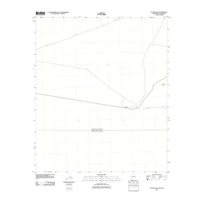
2010 Map of Coyote Hill
USGS Topo · Published 2010About this map
The international border between the United States and Mexico bisects the southern reaches of this landscape, marking a stark geopolitical boundary in the high desert of Luna County. Settlement is sparse, anchored by the small community of Arena situated near the intersection of several local routes. The terrain is characterized by the namesake Coyote Hill, a prominent rise in an otherwise open expanse of arid land. Transportation through this borderland depends on a network of unpaved roads, including County Rd-B003 and County Rd-B002, which connect the isolated homesteads and ranching interests to the wider region. This 2010 survey provides a precise view of the rural infrastructure and boundary lines at the turn of the decade.
Find a feature on this map
5 named features on this map. Tap any name to fly to it.
Don’t see what you’re looking for? This feature index may not catch every label — zoom into the map to look around manually.
Map Details
Editions of this 2010 Coyote Hill Map
This is the sole edition of this map. No revisions or reprints were ever made.
Other maps of this area

1917 · Camel Mountain
USGS Topo · 1:62,500

1917 · Columbus
USGS Topo · 1:62,500

1918 · Columbus
USGS Topo · 1:62,500

1920 · Columbus
USGS Topo · 1:62,500

1953 · El Paso
USGS Topo · 1:250,000

1959 · El Paso
USGS Topo · 1:250,000

1964 · El Paso
USGS Topo · 1:250,000

1965 · El Paso
USGS Topo · 1:250,000
1965 · Camel Mountain
USGS Topo · 1:24,000
1965 · P O L Ranch
USGS Topo · 1:24,000