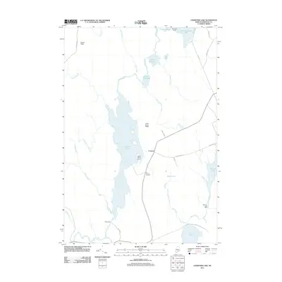
2011 Map of Crawford Lake
USGS Topo · Published 2011About this map
The Crawford settlement serves as the primary hub for this interior landscape in eastern Maine, where the vast waters of Crawford Lake dominate the central terrain. The map details a complex hydrologic network of interconnected lakes and streams, including the winding Maine River and the secluded Pocomoonshine Lake along the northern boundary. This drainage system was managed for local industry and water control, evidenced by infrastructure like the Pokey Dam and the Barrows Lake Dam. For genealogists and local historians, the Old Crawford Cemetery remains a significant landmark near the center of the township. The road network, including the aptly named Pokey Rd and Mud Lake Rd, provides access across the prominent Cedar Grove Ridge and Seavey Ridge, illustrating the relationship between the high ground and the extensive marshy lowlands of the East Machias River watershed.
Find a feature on this map
40 named features on this map. Tap any name to fly to it.
Don’t see what you’re looking for? This feature index may not catch every label — zoom into the map to look around manually.
Map Details
Editions of this 2011 Crawford Lake Map
This is the sole edition of this map. No revisions or reprints were ever made.
Other maps of this area

1929 · Calais
USGS Topo · 1:48,000

1932 · Calais
USGS Topo · 1:62,500

1941 · Wesley
USGS Topo · 1:62,500

1941 · Gardner Lake
USGS Topo · 1:62,500

1941 · Big Lake
USGS Topo · 1:62,500

1943 · Big Lake
USGS Topo · 1:62,500

1943 · Wesley
USGS Topo · 1:62,500

1943 · Gardner Lake
USGS Topo · 1:62,500

1952 · Big Lake
USGS Topo · 1:50,000

1957 · Fredericton
USGS Topo · 1:250,000