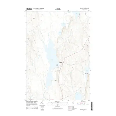
2014 Map of Crawford Lake
USGS Topo · Published 2014About this map
Crawford Lake and the surrounding Maine wilderness define this landscape, where water and ridge lines create a complex network of glacial drainage. The small settlement of Crawford serves as a central point along the historic Airline Rd, a route flanked by the Old Crawford Cem and the prominent Great Pine Point. The terrain is characterized by north-south elevations like Cedar Grove Ridge and Huntley Ridge, which funnel numerous streams including Mill Brook and Seavey Brook toward the East Machias River system.
Find a feature on this map
45 named features on this map. Tap any name to fly to it.
Don’t see what you’re looking for? This feature index may not catch every label — zoom into the map to look around manually.
Map Details
Editions of this 2014 Crawford Lake Map
This is the sole edition of this map. No revisions or reprints were ever made.
Other maps of this area

1929 · Calais
USGS Topo · 1:48,000

1932 · Calais
USGS Topo · 1:62,500

1941 · Wesley
USGS Topo · 1:62,500

1941 · Gardner Lake
USGS Topo · 1:62,500

1941 · Big Lake
USGS Topo · 1:62,500

1943 · Big Lake
USGS Topo · 1:62,500

1943 · Wesley
USGS Topo · 1:62,500

1943 · Gardner Lake
USGS Topo · 1:62,500

1952 · Big Lake
USGS Topo · 1:50,000

1957 · Fredericton
USGS Topo · 1:250,000