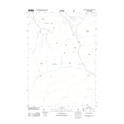
2012 Map of Crawford Notch
USGS Topo · Published 2012About this map
Crawford House stands at the northern gateway of this high mountain pass, marking a landscape defined by dramatic geological features and a long history of tourism. The terrain drops through the narrow gap of Zealand Notch, where the N Fork E Br Pemigewasset River and Saco River drain opposite sides of the divide. The map documents numerous landmarks essential to the region's heritage, including the Willey House and nearby Willey House Camps, which recall the early pioneers and travelers who navigated the Notch. Hikers and historians can trace the paths to significant natural features like Zealand Falls, Arethusa Falls, and Ripley Falls, or find the Ethan Pond Shelter along the higher elevations. From the heights of Mount Tom to the distinctive profile of Elephant Head, the survey details the water bodies and summits that have made this a focal point of the White Mountains.
Find a feature on this map
55 named features on this map. Tap any name to fly to it.
Don’t see what you’re looking for? This feature index may not catch every label — zoom into the map to look around manually.
Map Details
Editions of this 2012 Crawford Notch Map
This is the sole edition of this map. No revisions or reprints were ever made.
Other maps of this area

1893 · Mt. Washington
USGS Topo · 1:62,500

1895 · Crawford Notch
USGS Topo · 1:62,500

1896 · Mt. Washington
USGS Topo · 1:62,500

1896 · Crawford Notch
USGS Topo · 1:62,500

1900 · Whitefield
USGS Topo · 1:62,500

1929 · Franconia
USGS Topo · 1:62,500

1932 · Franconia
USGS Topo · 1:62,500

1935 · Whitefield
USGS Topo · 1:48,000

1935 · Mt. Washington
USGS Topo · 1:62,500
1938 · Mt. Washington
USGS Topo · 1:62,500