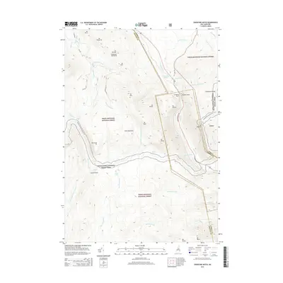
2015 Map of Crawford Notch
USGS Topo · Published 2015About this map
Crawford Notch and Zealand Notch define the high-altitude topography of this portion of the White Mountain National Forest. The landscape is a network of steep drainages and prominent peaks, including Mt Willard, Mt Field, and Mt Willey, which overlook the winding course of the Saco River and Crawford Notch Rd. This area serves as a critical junction for backcountry travel, where the Appalachian National Scenic Trail traverses the high ridges and passes through notable sites such as Zealand Falls. Numerous other cascades, including Thoreau Falls, Silver Cascade, and Arethusa Falls, mark the various brooks and river forks that drain the interior wilderness. The concentration of named ponds like Ethan Pond and Shoal Pond highlights the glaciated character of these mountain basins.
Find a feature on this map
58 named features on this map. Tap any name to fly to it.
Don’t see what you’re looking for? This feature index may not catch every label — zoom into the map to look around manually.
Map Details
Editions of this 2015 Crawford Notch Map
This is the sole edition of this map. No revisions or reprints were ever made.
Other maps of this area

1893 · Mt. Washington
USGS Topo · 1:62,500

1895 · Crawford Notch
USGS Topo · 1:62,500

1896 · Mt. Washington
USGS Topo · 1:62,500

1896 · Crawford Notch
USGS Topo · 1:62,500

1900 · Whitefield
USGS Topo · 1:62,500

1929 · Franconia
USGS Topo · 1:62,500

1932 · Franconia
USGS Topo · 1:62,500

1935 · Whitefield
USGS Topo · 1:48,000

1935 · Mt. Washington
USGS Topo · 1:62,500
1938 · Mt. Washington
USGS Topo · 1:62,500