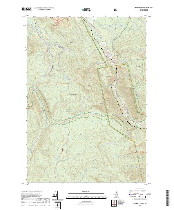
2024 Map of Crawford Notch
USGS Topo · Published 2024About this map
Crawford Notch and Zealand Notch define this section of the White Mountain National Forest, where the headwaters of the Saco River and the Zealand River originate. The map records a landscape deeply intersected by protected lands, including the Pemigewasset Wilderness and the Presidential Range-Dry River Wilderness. These wild areas are linked by a dense network of high-elevation paths, most notably the Appalachian National Scenic Trail, which traverses the southern terrain near Ethan Pond.
Find a feature on this map
85 named features on this map. Tap any name to fly to it.
Don’t see what you’re looking for? This feature index may not catch every label — zoom into the map to look around manually.
Map Details
Editions of this 2024 Crawford Notch Map
This is the sole edition of this map. No revisions or reprints were ever made.
Other maps of this area

1893 · Mt. Washington
USGS Topo · 1:62,500

1895 · Crawford Notch
USGS Topo · 1:62,500

1896 · Mt. Washington
USGS Topo · 1:62,500

1896 · Crawford Notch
USGS Topo · 1:62,500

1900 · Whitefield
USGS Topo · 1:62,500

1929 · Franconia
USGS Topo · 1:62,500

1932 · Franconia
USGS Topo · 1:62,500

1935 · Whitefield
USGS Topo · 1:48,000

1935 · Mt. Washington
USGS Topo · 1:62,500
1938 · Mt. Washington
USGS Topo · 1:62,500