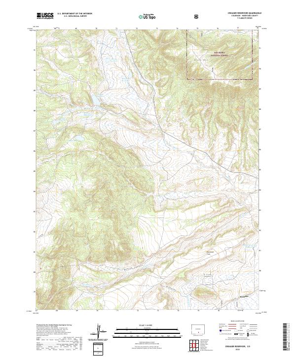
2022 Map of Creager Reservoir
USGS Topo · Published 2022About this map
Malachite and the Wolf Springs Ranch anchor the southern reaches of this landscape, where the high plains of Huerfano County meet the eastern edge of the San Isabel National Forest. The geography is defined by a complex system of water management, evidenced by numerous high-altitude catchments including Creager Reservoir, Murray Reservoir, and McKinley Reservoir. These water bodies, along with smaller features like Wolf Reservoir and Roach Reservoir, indicate a history of ranching and irrigation in this semi-arid environment.
Find a feature on this map
31 named features on this map. Tap any name to fly to it.
Don’t see what you’re looking for? This feature index may not catch every label — zoom into the map to look around manually.
Map Details
Editions of this 2022 Creager Reservoir Map
This is the sole edition of this map. No revisions or reprints were ever made.
Other maps of this area

1889 · Huerfano Park
USGS Topo · 1:125,000

1892 · Huerfano Park
USGS Topo · 1:125,000

1954 · Trinidad
USGS Topo · 1:250,000

1955 · Trinidad
USGS Topo · 1:250,000

1958 · Trinidad
USGS Topo · 1:250,000

1959 · Trinidad
USGS Topo · 1:250,000
1960 · Beck Mountain
USGS Topo · 1:24,000
1960 · Devils Gulch
USGS Topo · 1:24,000

1967 · Mosca Pass
USGS Topo · 1:24,000
1967 · Creager Reservoir
USGS Topo · 1:24,000