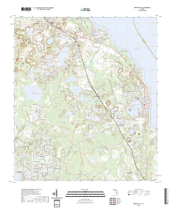
2024 Map of Crescent City
USGS Topo · Published 2024About this map
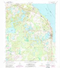
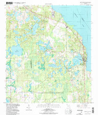
The lacustrine landscape of Putnam County is defined here by the vast waters of Crescent Lake, where Hurricane Point and Weidernoch Point reach into the eastern shoreline. The modern settlement pattern is anchored by Crescent City and Pomona Park, connected by the historic corridor of Old US Hwy 17 and the CSX Transportation rail line. Smaller communities and landings such as Lake Como, Huntington, and Georgetown are interspersed among a dense concentration of smaller water bodies, including Silver Lake, Stella Lake, and Lake Lillie.
Find a feature on this map
216 named features on this map. Tap any name to fly to it.
Don’t see what you’re looking for? This feature index may not catch every label — zoom into the map to look around manually.
Map Details
Editions of this 2024 Crescent City Map
This is the sole edition of this map. No revisions or reprints were ever made.
Historical Maps of Hammond Through Time
3 maps found