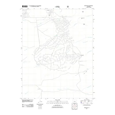
2011 Map of Crestone
USGS Topo · Published 2011About this map
Crestone serves as the focal point of this 2011 survey, situated at the base of the mountains where North Crestone Creek and South Crestone Creek emerge from the high country. The landscape transition is marked by a complex network of residential roads south of the main town site, including Camino Baca Grande and N Carefree Way, indicating the modern development of the Baca Grande area. Cultural and natural landmarks such as Teton Cemetery and Burnt Gulch lie just south of the town center, while the rugged drainage systems of Spanish Creek and Cottonwood Creek dominate the central and southern portions of the map.
Find a feature on this map
33 named features on this map. Tap any name to fly to it.
Don’t see what you’re looking for? This feature index may not catch every label — zoom into the map to look around manually.
Map Details
Editions of this 2011 Crestone Map
This is the sole edition of this map. No revisions or reprints were ever made.
Other maps of this area

1954 · Trinidad
USGS Topo · 1:250,000

1954 · Pueblo
USGS Topo · 1:250,000

1955 · Trinidad
USGS Topo · 1:250,000

1957 · Pueblo
USGS Topo · 1:250,000

1958 · Trinidad
USGS Topo · 1:250,000

1958 · Pueblo
USGS Topo · 1:250,000

1959 · Trinidad
USGS Topo · 1:250,000

1959 · Electric Peak
USGS Topo · 1:62,500
1959 · Horn Peak
USGS Topo · 1:24,000

1962 · Pueblo
USGS Topo · 1:250,000