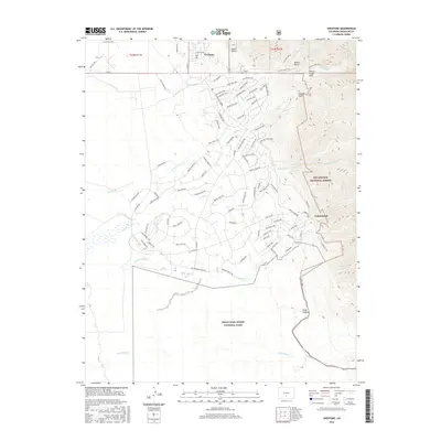
2016 Map of Crestone
USGS Topo · Published 2016About this map
Crestone sits at the foot of the Sangre de Cristo Mountains, serving as a hub for a network of residential roads and mountain access points. The community's local history is anchored by the Cem on Cemetary Rd, while the surrounding landscape is defined by drainage systems like N Crestone Cr, Willow Cr, and Spanish Cr. This 2016 survey illustrates the extensive residential development of the Baca Grande area, where roads like Baca Grant Way and Cam Real weave through the foothills.
Find a feature on this map
99 named features on this map. Tap any name to fly to it.
Don’t see what you’re looking for? This feature index may not catch every label — zoom into the map to look around manually.
Map Details
Editions of this 2016 Crestone Map
This is the sole edition of this map. No revisions or reprints were ever made.
Other maps of this area

1954 · Trinidad
USGS Topo · 1:250,000

1954 · Pueblo
USGS Topo · 1:250,000

1955 · Trinidad
USGS Topo · 1:250,000

1957 · Pueblo
USGS Topo · 1:250,000

1958 · Trinidad
USGS Topo · 1:250,000

1958 · Pueblo
USGS Topo · 1:250,000

1959 · Trinidad
USGS Topo · 1:250,000

1959 · Electric Peak
USGS Topo · 1:62,500
1959 · Horn Peak
USGS Topo · 1:24,000

1962 · Pueblo
USGS Topo · 1:250,000