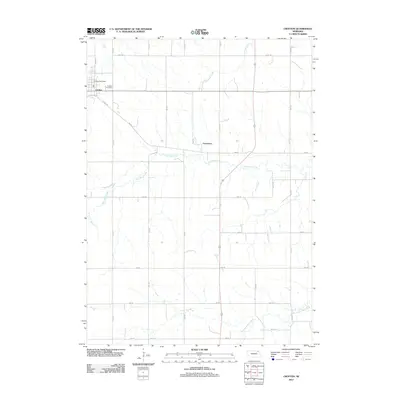
2011 Map of Crofton
USGS Topo · Published 2011About this map
Crofton and the smaller community of Constance anchor this northeastern Nebraska landscape, which is defined by a rigorous section-line road grid and meandering watercourses. The local terrain is drained by the branches of West Bow Creek, which winds across the central portion of the map, and Norwegian Bow Creek to the south. In the town of Crofton, key community landmarks such as the Crofton Post Office and Crofton Cemetery are clearly documented, providing essential data for local historians and genealogists. The road network, including Knox Ave and E Omaha St, illustrates the early 21st-century connectivity between these agricultural hubs and the surrounding rural acreage. The mapping of Antelope Creek further reveals the natural drainage patterns that have influenced land use in this part of Knox County for generations.
Find a feature on this map
25 named features on this map. Tap any name to fly to it.
Don’t see what you’re looking for? This feature index may not catch every label — zoom into the map to look around manually.
Map Details
Editions of this 2011 Crofton Map
This is the sole edition of this map. No revisions or reprints were ever made.
Other maps of this area

1955 · Sioux City
USGS Topo · 1:250,000

1958 · Sioux City
USGS Topo · 1:250,000

1959 · Sioux City
USGS Topo · 1:250,000

1968 · Tabor SE
USGS Topo · 1:24,000

1968 · Hartington
USGS Topo · 1:24,000

1968 · Bloomfield NE
USGS Topo · 1:24,000

1968 · Hartington SW
USGS Topo · 1:24,000

1968 · Gavins Point Dam
USGS Topo · 1:24,000

1968 · Bloomfield SE
USGS Topo · 1:24,000

1968 · Crofton
USGS Topo · 1:24,000