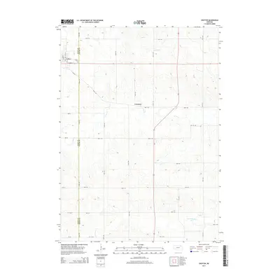
2014 Map of Crofton
USGS Topo · Published 2014About this map
Crofton serves as the primary hub in this corner of Northeast Nebraska, situated along the western edge of the Knox and Cedar county line. The landscape is defined by the winding paths of several creeks, including Antelope Cr to the north and the branching waters of W Bow Cr and Norwegian Bow Cr further south. The map illustrates a strictly organized agricultural grid, with numbered rural routes such as 887th Rd and 891st Rd segmenting the undulating prairie terrain. Local history and genealogy researchers will find the Crofton Cem near the town center and the small settlement of Constance to the east, providing a clear record of the community's footprint in the early 21st century. The density of these rural road networks reflects a region deeply rooted in its homesteading patterns and established farmsteads.
Find a feature on this map
22 named features on this map. Tap any name to fly to it.
Don’t see what you’re looking for? This feature index may not catch every label — zoom into the map to look around manually.
Map Details
Editions of this 2014 Crofton Map
This is the sole edition of this map. No revisions or reprints were ever made.
Other maps of this area

1955 · Sioux City
USGS Topo · 1:250,000

1958 · Sioux City
USGS Topo · 1:250,000

1959 · Sioux City
USGS Topo · 1:250,000

1968 · Tabor SE
USGS Topo · 1:24,000

1968 · Hartington
USGS Topo · 1:24,000

1968 · Bloomfield NE
USGS Topo · 1:24,000

1968 · Hartington SW
USGS Topo · 1:24,000

1968 · Gavins Point Dam
USGS Topo · 1:24,000

1968 · Bloomfield SE
USGS Topo · 1:24,000

1968 · Crofton
USGS Topo · 1:24,000