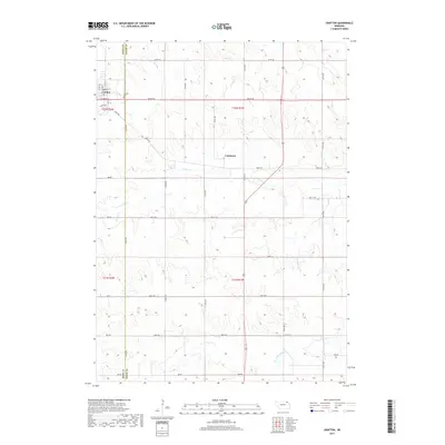
2017 Map of Crofton
USGS Topo · Published 2017About this map
Crofton serves as the primary center of activity on the border of Knox and Cedar counties, featuring a structured street grid that includes Main St and Omaha St. The landscape transitions from the developed town site to the agricultural fields and drainage basins of the Missouri River plateau. Waterways like W Bow Cr and Norwegian Bow Cr wind through the township sections, defining the local topography and drainage patterns. Near the town center, the Crofton Cem provides a point of genealogical interest, while further east, the small settlement of Constance represents the quieter, rural character of the region. The map captures the enduring section-line road network, such as 890th Rd and 552nd Ave, which has dictated the movement and settlement patterns of this Nebraska community for generations.
Find a feature on this map
37 named features on this map. Tap any name to fly to it.
Don’t see what you’re looking for? This feature index may not catch every label — zoom into the map to look around manually.
Map Details
Editions of this 2017 Crofton Map
This is the sole edition of this map. No revisions or reprints were ever made.
Other maps of this area

1955 · Sioux City
USGS Topo · 1:250,000

1958 · Sioux City
USGS Topo · 1:250,000

1959 · Sioux City
USGS Topo · 1:250,000

1968 · Tabor SE
USGS Topo · 1:24,000

1968 · Hartington
USGS Topo · 1:24,000

1968 · Bloomfield NE
USGS Topo · 1:24,000

1968 · Hartington SW
USGS Topo · 1:24,000

1968 · Gavins Point Dam
USGS Topo · 1:24,000

1968 · Bloomfield SE
USGS Topo · 1:24,000

1968 · Crofton
USGS Topo · 1:24,000