1944 Map of Crosby
USGS Topo · Published 1944About this map
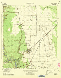
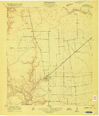
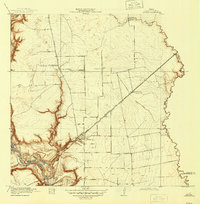
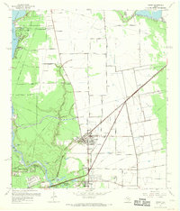
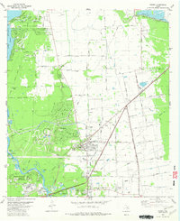
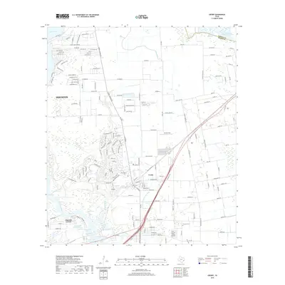
Crosby serves as the central hub of this 1944 survey, where the Southern Pacific railroad intersects with the Old Spanish Trail 90. The landscape is a complex mix of river bottomlands and emerging infrastructure, notably featuring the Water Supply Canal and the Industrial Water Supply Canal cutting through the terrain. To the southwest, the San Jacinto River meanders near Magnolia Gardens, creating a series of backwater features such as Black Lake, Simms Lake, and Big Eddy.
Find a feature on this map
55 named features on this map. Tap any name to fly to it.
Don’t see what you’re looking for? This feature index may not catch every label — zoom into the map to look around manually.
Map Details
Editions of this 1944 Crosby Map
This is the sole edition of this map. No revisions or reprints were ever made.
Historical Maps of Houston Through Time
11 maps found
1916 Crosby
Harris County, TX
1919 Crosby
Harris County, TX
1944 Crosby
Harris County, TX

1954 Crosby
Harris County, TX
1967 Crosby
Harris County, TX
1982 Crosby
Harris County, TX
2010 Crosby
Harris County, TX
2013 Crosby
Harris County, TX
2016 Crosby
Harris County, TX
2019 Crosby
Harris County, TX
2023 Crosby
Harris County, TX