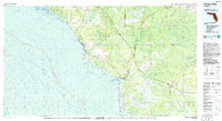
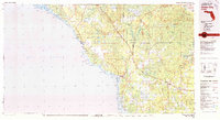
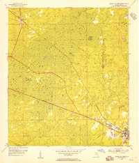
1978 Map of Cross City
USGS Topo · Published 1985About this map
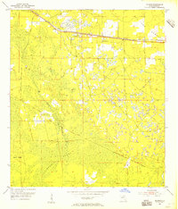
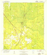
The Steinhatchee River carves a winding path through the Big Bend region, serving as a natural boundary during this late 1970s survey. To the east, the sprawling wetlands of Mallory Swamp, Pumpkin Swamp, and California Swamp dominate the interior, illustrating the difficult terrain that historically shaped settlement patterns in Dixie and Taylor Counties. The industrial and transit hub of Cross City is clearly visible alongside the neighboring communities of Shamrock and Eugene, which were traditionally tied to the local timber industry.
Find a feature on this map
45 named features on this map. Tap any name to fly to it.
Don’t see what you’re looking for? This feature index may not catch every label — zoom into the map to look around manually.
Map Details
Editions of this 1978 Cross City Map
2 editions found
Other maps of this area

1949 · Apalachicola
USGS Topo · 1:250,000
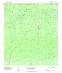
1954 · Mallory Swamp NW
USGS Topo · 1:24,000
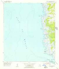
1954 · Steinhatchee SW
USGS Topo · 1:24,000
1954 · Cross City West
USGS Topo · 1:24,000
1954 · Eugene
USGS Topo · 1:24,000
1954 · Fenholloway
USGS Topo · 1:24,000
1954 · Day SE
USGS Topo · 1:24,000
1954 · Clara
USGS Topo · 1:24,000
1954 · Salem SW
USGS Topo · 1:24,000
1954 · Cross City East
USGS Topo · 1:24,000