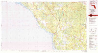
1978 Map of Cross City
USGS Topo · Published 1980About this map
Mallory Swamp and Pumpkin Swamp dominate this coastal Florida landscape, where the flat timberlands of the Big Bend meet the Gulf of Mexico. The regional economy of the late 1970s is reflected in the clustered settlements of Cross City, Shamrock, and Eugene, which serve as the inland hubs for the surrounding wilderness. The Seaboard Coast Line railroad provides a critical transportation artery, while an Old Railroad Grade suggests a legacy of earlier logging or industrial ventures throughout the wetlands. Along the jagged coastline, small communities like Keaton Beach and Dekle Beach are joined by numerous islands and points, including Pine Log Island and Cedar Island. The Steinhatchee River cuts a prominent path through the swamps of Taylor and Dixie Counties, marking a transition from the dense interior hammocks to the maritime environments of Deadman Bay.
Find a feature on this map
57 named features on this map. Tap any name to fly to it.
Don’t see what you’re looking for? This feature index may not catch every label — zoom into the map to look around manually.
Map Details
Editions of this 1978 Cross City Map
2 editions found
Other maps of this area

1949 · Apalachicola
USGS Topo · 1:250,000

1954 · Mallory Swamp NW
USGS Topo · 1:24,000

1954 · Steinhatchee SW
USGS Topo · 1:24,000

1954 · Cross City West
USGS Topo · 1:24,000

1954 · Eugene
USGS Topo · 1:24,000

1954 · Fenholloway
USGS Topo · 1:24,000

1954 · Day SE
USGS Topo · 1:24,000

1954 · Clara
USGS Topo · 1:24,000

1954 · Salem SW
USGS Topo · 1:24,000

1954 · Cross City East
USGS Topo · 1:24,000