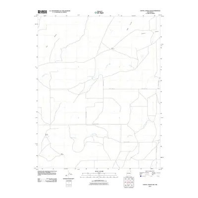
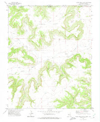
2010 Map of Cross L Ranch SW
USGS Topo · Published 2010About this map
Fleming Windmill, Twin Windmills, and Baker Windmill stand as essential water-management landmarks across this corner of Union County. The landscape is defined by the deep incisions of Cow Canyon, Halls Canyon, and Gleason Canyon in the north, while the southern reaches are drained by the winding courses of Travesser Creek and Spring Creek. This 2010 survey shows a high-plains ranching environment where movement is dictated by a grid of county roads, including County Hwy B-018 and County Rd-8020. The distribution of windmills highlights the critical nature of water access in this remote high-desert terrain, where small drainages provide the only natural breaks in the vast open range.
Find a feature on this map
17 named features on this map. Tap any name to fly to it.
Don’t see what you’re looking for? This feature index may not catch every label — zoom into the map to look around manually.
Map Details
Editions of this 2010 Cross L Ranch SW Map
This is the sole edition of this map. No revisions or reprints were ever made.
Other maps of this area

1954 · Dalhart
USGS Topo · 1:250,000

1958 · Dalhart
USGS Topo · 1:250,000

1962 · Dalhart
USGS Topo · 1:250,000

1972 · Emery Peak
USGS Topo · 1:24,000

1972 · Little Grande
USGS Topo · 1:24,000
1972 · Fiddler Springs
USGS Topo · 1:24,000
1972 · Cross L Ranch
USGS Topo · 1:24,000

1972 · Cross L Ranch SW
USGS Topo · 1:24,000
1972 · Des Moines
USGS Topo · 1:24,000
1972 · Cobert Mesa South
USGS Topo · 1:24,000