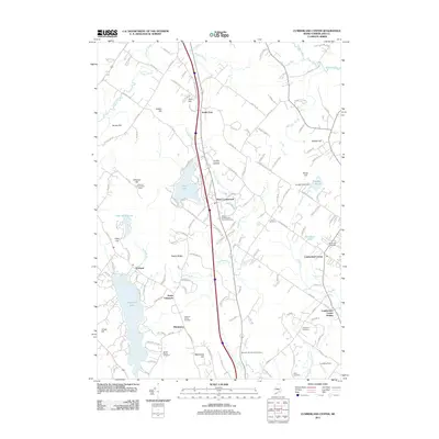
2011 Map of Cumberland Center
USGS Topo · Published 2011About this map
Cumberland Center anchors this part of Cumberland County, where the village and its nearby Cumberland Center Station sit along the historic path of the Grand Trunk RR. The landscape is a complex network of brooks and small rivers, including the winding Piscataqua River and Mill Brook, which cut through a series of significant heights like Atherton Hill and Blackstrap Hill. Genealogists will find a wealth of local history preserved in family-named plots such as the Huston Family Cemetery and Leighton Family Cemetery, alongside established community sites like Moss Side Cemetery. Small settlements like South Gray and West Cumberland are connected by a dense web of local roads, reflecting the steady suburban and rural development of the area at the start of the 21st century. High points are occasionally marked by infrastructure, such as the Atherton Hill Lookout Tower overlooking Forest Lake.
Find a feature on this map
141 named features on this map. Tap any name to fly to it.
Don’t see what you’re looking for? This feature index may not catch every label — zoom into the map to look around manually.
Map Details
Editions of this 2011 Cumberland Center Map
This is the sole edition of this map. No revisions or reprints were ever made.
Other maps of this area

1891 · Portland
USGS Topo · 1:62,500

1892 · Freeport
USGS Topo · 1:62,500

1893 · Portland
USGS Topo · 1:62,500

1893 · Casco Bay
USGS Topo · 1:62,500

1894 · Gray
USGS Topo · 1:62,500

1898 · Gray
USGS Topo · 1:62,500

1914 · Portland
USGS Topo · 1:48,000

1914 · Casco Bay
USGS Topo · 1:48,000

1916 · Portland
USGS Topo · 1:62,500

1916 · Casco Bay
USGS Topo · 1:62,500