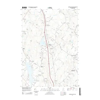
2014 Map of Cumberland Center
USGS Topo · Published 2014About this map
Cumberland Center and the surrounding villages of West Cumberland, South Gray, and North Falmouth reveal a landscape defined by traditional family landholdings and small-scale agriculture. This corner of Maine is densely mapped with lineage-based landmarks, including the Goudreau Family Burying Ground, Leighton Family Cem, and Huston Family Cem. The terrain rises from the shores of Highland Lake and Forest Lake toward prominent heights such as Blackstrap Hill and Atherton Hill, while the Piscataqua River and Mill Brook provide the primary drainage for the undulating interior.
Find a feature on this map
185 named features on this map. Tap any name to fly to it.
Don’t see what you’re looking for? This feature index may not catch every label — zoom into the map to look around manually.
Map Details
Editions of this 2014 Cumberland Center Map
This is the sole edition of this map. No revisions or reprints were ever made.
Other maps of this area

1891 · Portland
USGS Topo · 1:62,500

1892 · Freeport
USGS Topo · 1:62,500

1893 · Portland
USGS Topo · 1:62,500

1893 · Casco Bay
USGS Topo · 1:62,500

1894 · Gray
USGS Topo · 1:62,500

1898 · Gray
USGS Topo · 1:62,500

1914 · Portland
USGS Topo · 1:48,000

1914 · Casco Bay
USGS Topo · 1:48,000

1916 · Portland
USGS Topo · 1:62,500

1916 · Casco Bay
USGS Topo · 1:62,500