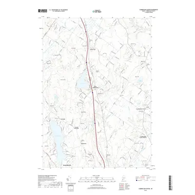
2018 Map of Cumberland Center
USGS Topo · Published 2018About this map
Highland Lake and Forest Lake anchor this portion of Cumberland County, where the landscape is defined by a dense network of family-named hills and ridges. The area around Blackstrap and North Falmouth reveals a storied settlement pattern, with numerous small family burial grounds like the Leighton Family Cem and Huston Family Cem preserved alongside larger community sites such as South Gray Cem. The eastern portion of the map is dominated by the community of Cumberland Center, positioned near the winding path of Mill Brook. The terrain transitions from the elevations of Blackstrap Hill and Atherton Hill toward the river valleys of the Pleasant River and Piscataqua River. This 2018 survey provides an exceptionally detailed record of local genealogy, documenting isolated graveyards like the Merrill Graveyard that might otherwise be overlooked in broader regional studies.
Find a feature on this map
166 named features on this map. Tap any name to fly to it.
Don’t see what you’re looking for? This feature index may not catch every label — zoom into the map to look around manually.
Map Details
Editions of this 2018 Cumberland Center Map
This is the sole edition of this map. No revisions or reprints were ever made.
Other maps of this area

1891 · Portland
USGS Topo · 1:62,500

1892 · Freeport
USGS Topo · 1:62,500

1893 · Portland
USGS Topo · 1:62,500

1893 · Casco Bay
USGS Topo · 1:62,500

1894 · Gray
USGS Topo · 1:62,500

1898 · Gray
USGS Topo · 1:62,500

1914 · Portland
USGS Topo · 1:48,000

1914 · Casco Bay
USGS Topo · 1:48,000

1916 · Portland
USGS Topo · 1:62,500

1916 · Casco Bay
USGS Topo · 1:62,500