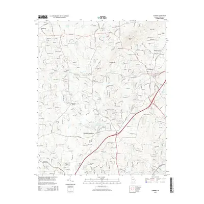
2014 Map of Cumming
USGS Topo · Published 2014About this map
Sawnee Mtn and the surrounding gaps of the Piedmont plateau overlook the rapidly developing suburbs and business corridors of Forsyth County. This 2014 survey captures the landscape of Cumming during a period of significant growth, evidenced by the dense network of roads like the Atlanta Hwy and Peachtree Pky. Amidst the modern subdivisions and retail centers, historical markers remain, including several local burying grounds such as Shiloh Cem, Friendship Cem, and the Cumming City Cem. The transition from rural roots to a suburban hub is visible in the presence of Stoney Point Airfield and specialized developments like The Polo Fields. Water resources are prominent throughout the quadrangle, from the northern Reservoir 30-A and Reservoir 30-B to the numerous small lakes and creeks, such as Big Cr and Mashburn Mill Lake, which weave through the residential and commercial blocks.
Find a feature on this map
53 named features on this map. Tap any name to fly to it.
Don’t see what you’re looking for? This feature index may not catch every label — zoom into the map to look around manually.
Map Details
Editions of this 2014 Cumming Map
This is the sole edition of this map. No revisions or reprints were ever made.
Other maps of this area

1890 · Suwanee
USGS Topo · 1:125,000

1894 · Suwanee
USGS Topo · 1:125,000

1926 · Tate
USGS Topo · 1:62,500

1928 · Tate
USGS Topo · 1:62,500

1955 · Rome
USGS Topo · 1:250,000

1956 · Duluth
USGS Topo · 1:24,000

1956 · Roswell
USGS Topo · 1:24,000

1956 · Birmingham
USGS Topo · 1:24,000

1958 · Rome
USGS Topo · 1:250,000

1961 · Rome
USGS Topo · 1:250,000