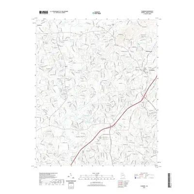
2020 Map of Cumming
USGS Topo · Published 2020About this map
Cumming serves as the focal point of this Forsyth County landscape, anchored by the Forsyth County Courthouse and the nearby Cumming City Cem. The topography is defined by the prominent ridge of Sawnee Mtn, which creates natural passages such as Sawnee Gap and Chamblee Gap. This area demonstrates a mix of established community centers and growing infrastructure, with Lanier Technical College positioned near the intersection of modern transit corridors like Ga 400. To the west, the settlements of Ducktown and Drew occupy the higher ground near Yellow Cr. Water resources are prevalent throughout the quadrangle, ranging from the Cumming Twin Lake-Number One and Sawnee Lake to numerous named branches like Kelley Mill Br and Sawmill Br. Genealogists will find several rural burial grounds including Bethlehem Cem and Haw Creek Cem scattered among the valleys.
Find a feature on this map
50 named features on this map. Tap any name to fly to it.
Don’t see what you’re looking for? This feature index may not catch every label — zoom into the map to look around manually.
Map Details
Editions of this 2020 Cumming Map
This is the sole edition of this map. No revisions or reprints were ever made.
Other maps of this area

1890 · Suwanee
USGS Topo · 1:125,000

1894 · Suwanee
USGS Topo · 1:125,000

1926 · Tate
USGS Topo · 1:62,500

1928 · Tate
USGS Topo · 1:62,500

1955 · Rome
USGS Topo · 1:250,000

1956 · Duluth
USGS Topo · 1:24,000

1956 · Roswell
USGS Topo · 1:24,000

1956 · Birmingham
USGS Topo · 1:24,000

1958 · Rome
USGS Topo · 1:250,000

1961 · Rome
USGS Topo · 1:250,000