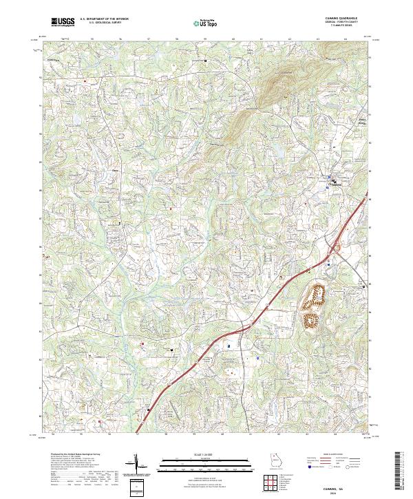
2024 Map of Cumming
USGS Topo · Published 2024About this map
Sawnee Mountain dominates the northern horizon of this Forsyth County landscape, where the ridges of the Piedmont meet the growing infrastructure of Cumming. The town center is clearly defined by civic anchors like the Forsyth County Courthouse and Forsyth County Juvenile Court, surrounded by established residential areas and the newer developments of Pirkle Woods. This contemporary survey captures a region where historic rural identifiers, such as Mars Hill Cemetery and Bethlehem Cemetery, now sit alongside modern institutions like Lanier Technical College.
Find a feature on this map
357 named features on this map. Tap any name to fly to it.
Don’t see what you’re looking for? This feature index may not catch every label — zoom into the map to look around manually.
Map Details
Editions of this 2024 Cumming Map
This is the sole edition of this map. No revisions or reprints were ever made.
Other maps of this area

1890 · Suwanee
USGS Topo · 1:125,000

1894 · Suwanee
USGS Topo · 1:125,000

1926 · Tate
USGS Topo · 1:62,500

1928 · Tate
USGS Topo · 1:62,500

1955 · Rome
USGS Topo · 1:250,000

1956 · Duluth
USGS Topo · 1:24,000

1956 · Roswell
USGS Topo · 1:24,000

1956 · Birmingham
USGS Topo · 1:24,000

1958 · Rome
USGS Topo · 1:250,000

1961 · Rome
USGS Topo · 1:250,000