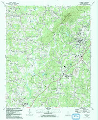
1992 Map of Cumming
USGS Topo · Published 1993About this map
Sawnee Mountain dominates the northern skyline of this Forsyth County region, providing a rugged backdrop to the rapidly expanding community of Cumming. By the early 1990s, the landscape shows a transition from rural Piedmont terrain to a burgeoning suburban hub, evidenced by the presence of institutions like Forsyth Central High Sch and South Forsyth High Sch. The network of local roads such as Bentley Road and Bethelview Road connects long-established landmarks like Friendship Ch and Ducktown with newer developments. Water features define the lowlands, from the winding course of Big Creek to smaller bodies like Lake Alice and Odum Lake. This era represents a significant period of growth just before the extensive modern sprawl reached this part of the Atlanta metropolitan fringe, preserving the locations of numerous country churches such as Daves Creek Ch and Pleasant View Ch alongside industrial sites like the local Quarry.
Find a feature on this map
87 named features on this map. Tap any name to fly to it.
Don’t see what you’re looking for? This feature index may not catch every label — zoom into the map to look around manually.
Map Details
Editions of this 1992 Cumming Map
This is the sole edition of this map. No revisions or reprints were ever made.
Other maps of this area

1890 · Suwanee
USGS Topo · 1:125,000

1894 · Suwanee
USGS Topo · 1:125,000

1926 · Tate
USGS Topo · 1:62,500

1928 · Tate
USGS Topo · 1:62,500

1955 · Rome
USGS Topo · 1:250,000

1956 · Duluth
USGS Topo · 1:24,000

1956 · Roswell
USGS Topo · 1:24,000

1956 · Birmingham
USGS Topo · 1:24,000

1958 · Rome
USGS Topo · 1:250,000

1961 · Rome
USGS Topo · 1:250,000