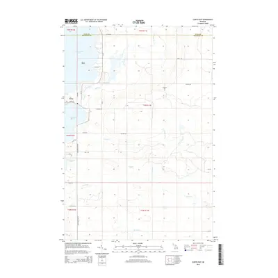
2014 Map of Curtis East
USGS Topo · Published 2014About this map
Curtis sits on the western edge of this Upper Peninsula landscape, where the waters of Manistique Lake and S Manistique Lake dominate the geography. This 2014 survey reveals a transition from lakefront property and small settlements to the densely forested interior of Mackinac County. The map details a complex hydrographic network, including the Black Creek Flooding and the headwaters of numerous creeks like Portage Creek and Upper Black Cr that drain the timberlands. Cultural markers for genealogists and local historians include the Sandtown Cem located along Sandtown Rd. The terrain is characterized by low-lying basins and wetlands, evidenced by names like Furlong Pond and Spot Lake, reflecting the post-glacial swampy character typical of the region north of Lake Michigan. Forest trails and secondary roads such as Manistique Lakes Rd provide the primary access to these inland woods.
Find a feature on this map
44 named features on this map. Tap any name to fly to it.
Don’t see what you’re looking for? This feature index may not catch every label — zoom into the map to look around manually.
Map Details
Editions of this 2014 Curtis East Map
This is the sole edition of this map. No revisions or reprints were ever made.
Other maps of this area

1931 · Gould City NE
USGS Topo · 1:31,680

1931 · Gould City NW
USGS Topo · 1:31,680

1931 · Seney SE
USGS Topo · 1:31,680

1931 · Blaney NE
USGS Topo · 1:31,680

1931 · Gould City SE
USGS Topo · 1:31,680

1931 · Blaney SE
USGS Topo · 1:31,680

1954 · Sault Sainte Marie
USGS Topo · 1:250,000

1956 · Sault Sainte Marie
USGS Topo · 1:250,000

1957 · Sault Sainte Marie
USGS Topo · 1:250,000

1958 · Sault Sainte Marie
USGS Topo · 1:250,000