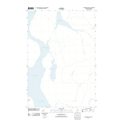
2011 Map of Cuxabexis Lake
USGS Topo · Published 2011About this map
Chesuncook Lake dominates the western half of this North Woods landscape, serving as a primary waterway for the Piscataquis County interior. In the early 2010s, this area remained characterized by its dense hydrological network, where Cuxabexis Lake drains through Cuxabexis Stream into the larger basin. The terrain is defined by low-lying wetlands and complex drainage patterns, with smaller water bodies like Duck Pond and seasonal flows such as West Branch Red Brook illustrating the natural topography of the Maine wilderness. Human presence is limited to the periphery, notably along the North Rd corridor, while prominent natural features like Togue Ledge mark the western shoreline. This map provides a detailed record of the riparian systems including Logan Brook and the West Branch Ripogenus Stream, which are vital for understanding the historical logging and recreational routes of the region.
Find a feature on this map
11 named features on this map. Tap any name to fly to it.
Don’t see what you’re looking for? This feature index may not catch every label — zoom into the map to look around manually.
Map Details
Editions of this 2011 Cuxabexis Lake Map
This is the sole edition of this map. No revisions or reprints were ever made.
Other maps of this area

1953 · Telos Lake
USGS Topo · 1:62,500

1954 · Chesuncook
USGS Topo · 1:62,500

1954 · Grant Farm
USGS Topo · 1:62,500

1954 · Harrington Lake
USGS Topo · 1:62,500

1954 · Presque Isle
USGS Topo · 1:250,000

1954 · Millinocket
USGS Topo · 1:250,000

1957 · Telos Lake
USGS Topo · 1:62,500

1958 · Presque Isle
USGS Topo · 1:250,000

1958 · Millinocket
USGS Topo · 1:250,000

1958 · Chesuncook
USGS Topo · 1:62,500