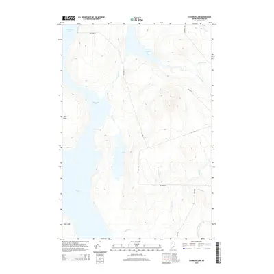
2014 Map of Cuxabexis Lake
USGS Topo · Published 2014About this map
Chesuncook Lake dominates the western portion of this Maine wilderness landscape, providing a primary waterway that defines the character of the north woods. The central terrain is shaped by the presence of Duck Pond and the winding course of Cuxabexis Stream, which flows between the pond and Cuxabexis Lake to the north. A network of unpaved logging infrastructure, including Harvester Rd and Cuxabexis Rd, cuts through the forested elevations, indicating the area's continued use for timber management. Along the shores of the main lake, features like Gero Island and Togue Ledge mark key points for navigators and those familiar with the shoreline. The drainage patterns of the eastern hills are traced by Logan Brook and Red Brook, illustrating the complex watershed that feeds into the larger lake systems during the early twenty-first century.
Find a feature on this map
18 named features on this map. Tap any name to fly to it.
Don’t see what you’re looking for? This feature index may not catch every label — zoom into the map to look around manually.
Map Details
Editions of this 2014 Cuxabexis Lake Map
This is the sole edition of this map. No revisions or reprints were ever made.
Other maps of this area

1953 · Telos Lake
USGS Topo · 1:62,500

1954 · Chesuncook
USGS Topo · 1:62,500

1954 · Grant Farm
USGS Topo · 1:62,500

1954 · Harrington Lake
USGS Topo · 1:62,500

1954 · Presque Isle
USGS Topo · 1:250,000

1954 · Millinocket
USGS Topo · 1:250,000

1957 · Telos Lake
USGS Topo · 1:62,500

1958 · Presque Isle
USGS Topo · 1:250,000

1958 · Millinocket
USGS Topo · 1:250,000

1958 · Chesuncook
USGS Topo · 1:62,500