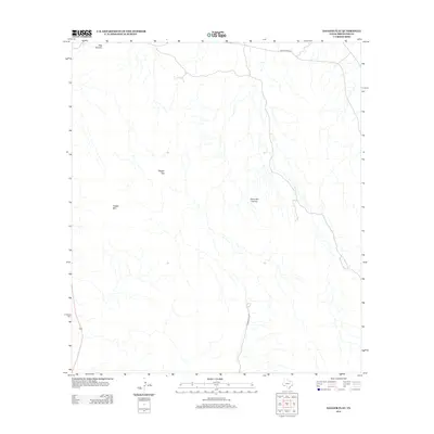
2012 Map of Dagger Flat
USGS Topo · Published 2012About this map
Sierra del Carmen dominates the eastern horizon of this arid Brewster County landscape, where the Chihuahuan Desert terrain is defined by dry washes and prominent limestone formations. The central basin of Dagger Flat sits between the rising slopes of Dagger Mtn and the larger mountain range, illustrating a classic desert drainage pattern that feeds toward the Rio Grande corridor. Human infrastructure is sparse, limited primarily to Ranch Road 2627 cutting across the northern reaches and Dagger Flat Rd providing access to the interior. The presence of Dog Canyon in the northwest corner highlights the dramatic erosion and topographical shifts common to this corner of the Big Bend region, offering a clear view of the natural corridors used for travel through the desert long before modern roadways.
Find a feature on this map
6 named features on this map. Tap any name to fly to it.
Don’t see what you’re looking for? This feature index may not catch every label — zoom into the map to look around manually.
Map Details
Editions of this 2012 Dagger Flat Map
This is the sole edition of this map. No revisions or reprints were ever made.
Other maps of this area

1903 · Chisos Mountains
USGS Topo · 1:125,000

1905 · Chisos Mountains
USGS Topo · 1:125,000

1917 · Bone Spring
USGS Topo · 1:62,500

1918 · Bone Spring
USGS Topo · 1:125,000

1918 · Bone Spring
USGS Topo · 1:62,500

1919 · Maravillas Canyon
USGS Topo · 1:62,500

1920 · Bone Spring
USGS Topo · 1:62,500

1930 · Stillwell Creek
USGS Topo · 1:62,500

1959 · Emory Peak
USGS Topo · 1:250,000

1965 · Emory Peak
USGS Topo · 1:250,000