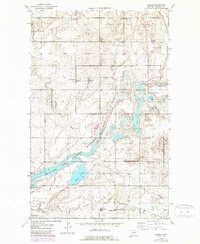
1946 Map of Dagmar
USGS Topo · Published 1989About this map
Dagmar anchors this landscape in Sheridan County, where the agricultural grid meets the extensive wetlands of the Medicine Lake National Wildlife Refuge. The map reveals a community deeply rooted in its rural infrastructure, evidenced by a high density of small country schools including Roosevelt Sch, Hiawatha Sch, Franklin Sch, and the notably named Hans Christian Andersen Sch. These institutions, alongside Volmer Ch, suggest a formerly robust local population distributed across the prairie.
Find a feature on this map
16 named features on this map. Tap any name to fly to it.
Don’t see what you’re looking for? This feature index may not catch every label — zoom into the map to look around manually.
Map Details
Editions of this 1946 Dagmar Map
2 editions found
Other maps of this area

1946 · Brush Lake
USGS Topo · 1:24,000

1946 · Dagmar
USGS Topo · 1:24,000

1947 · Capeneys Lake
USGS Topo · 1:24,000

1948 · Capeneys Lake
USGS Topo · 1:24,000

1948 · Dagmar
USGS Topo · 1:24,000

1948 · Brush Lake
USGS Topo · 1:24,000

1948 · Reserve SE
USGS Topo · 1:24,000

1948 · Sunnyhill School
USGS Topo · 1:24,000

1949 · Reserve SE
USGS Topo · 1:24,000

1949 · Sunnyhill School
USGS Topo · 1:24,000