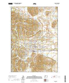
2020 Map of Dallas
USGS Topo · Published 2020About this map
The Polk County Courthouse stands as the central landmark of Dallas, anchoring a detailed street grid that transitions into the agricultural and timbered landscapes of the Willamette Valley. This 2020 edition reveals a complex network of water management, evidenced by dozens of named reservoirs like Aebi Reservoir and Schierling Reservoir, and intricate wetlands such as Baskett Slough and Hoekstre Slough. For genealogists, the map is particularly detailed, locating several burial sites including Dallas Cem, Fast Cem, and the Salt Creek Cem near the banks of Salt Creek. The surrounding area includes the smaller communities of Ellendale and Fir-Villa, while the terrain rises toward prominent elevations like Mt Baldy and Mt Pisgah. To the east, the Moffitti Marsh Trail and Cackler Marsh Trail weave through the lowlands, illustrating the modern conservation and recreation footprint in this long-settled region.
Find a feature on this map
156 named features on this map. Tap any name to fly to it.
Don’t see what you’re looking for? This feature index may not catch every label — zoom into the map to look around manually.
Map Details
Editions of this 2020 Dallas Map
This is the sole edition of this map. No revisions or reprints were ever made.
Other maps of this area

1914 · Independence
USGS Topo · 1:31,680

1915 · Rickreall
USGS Topo · 1:31,680

1917 · Salem
USGS Topo · 1:62,500

1922 · Airlie
USGS Topo · 1:31,680

1924 · Mc Minnville
USGS Topo · 1:48,000

1926 · Mc Minnville
USGS Topo · 1:62,500

1940 · McMinnville
USGS Topo · 1:62,500

1940 · Salem
USGS Topo · 1:62,500

1942 · Sheridan
USGS Topo · 1:62,500

1942 · Dallas
USGS Topo · 1:62,500