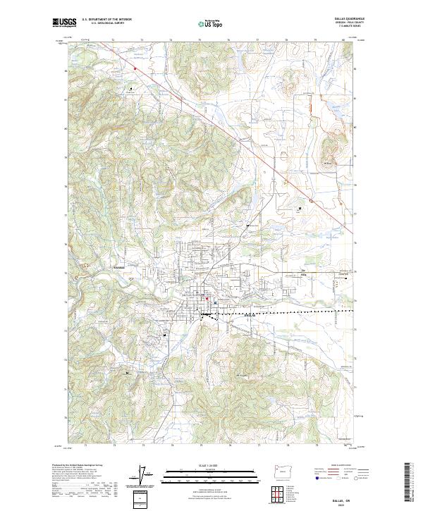
2023 Map of Dallas
USGS Topo · Published 2023About this map
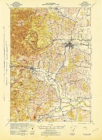
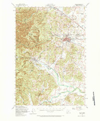
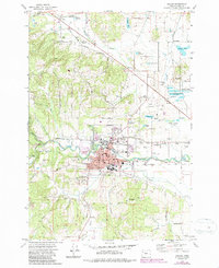
Dallas serves as the civic heart of this Polk County landscape, anchored by the Polk County Courthouse and a detailed grid of residential streets. The town is situated where Rickreall Creek flows eastward, surrounded by an extensive network of family-named water features like Aebi Reservoir, Domaschofsky Reservoir, and Schierling Reservoir. These numerous small impoundments suggest a history of sophisticated water management for local agriculture and industry. To the northeast, the Baskett Slough National Wildlife Refuge preserves the low-lying wetlands around Baskett Slough, while Mt Pisgah and Mt Baldy provide significant topographical relief. Genealogists will find several burial grounds across the quadrangle, including the Salt Creek Cem in the north and the Cadle Hill Embree Cem near Villa. The settlement of Ellendale sits to the west, where Ellendale Creek joins the larger drainage system.
Find a feature on this map
160 named features on this map. Tap any name to fly to it.
Don’t see what you’re looking for? This feature index may not catch every label — zoom into the map to look around manually.
Map Details
Editions of this 2023 Dallas Map
This is the sole edition of this map. No revisions or reprints were ever made.
Historical Maps of Fir Villa Through Time
4 maps found