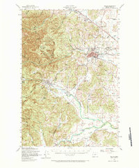
1957 Map of Dallas
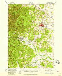
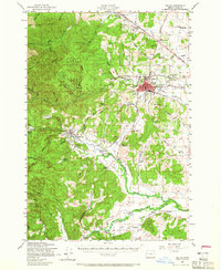
USGS Topo · Published 1984About this map
The timbered slopes of Siuslaw National Forest and the agricultural flats of the Willamette Valley meet here in mid-century Polk County. The city of Dallas stands as the primary hub, surrounded by smaller agrarian communities such as Rickreall, Fir Villa, and Smithfield. Transportation is anchored by the Southern Pacific and Valley and Siletz railroads, which facilitated the movement of lumber and produce between the Coast Range and the valley floor. Rural life is meticulously documented through numerous country schools, including Oakhurst School and Antioch School, along with local gathering spots like the Farmers Union Hall. The Little Luckiamute River and Rickreall Creek provide the primary drainage for this landscape of ridges and hollows, while landmarks such as the Drive-in Theater and Camp Kilowan reflect the mid-century recreational character of the region.
Find a feature on this map
62 named features on this map. Tap any name to fly to it.
Don’t see what you’re looking for? This feature index may not catch every label — zoom into the map to look around manually.
Map Details
Editions of this 1957 Dallas Map
3 editions found
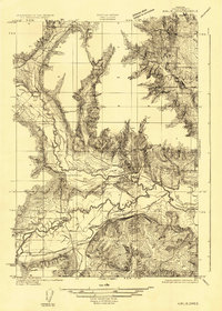
Other maps of this area

1913 · Wells
USGS Topo · 1:31,680

1914 · Independence
USGS Topo · 1:31,680

1914 · Soap Creek
USGS Topo · 1:31,680

1915 · Rickreall
USGS Topo · 1:31,680

1916 · Albany
USGS Topo · 1:62,500

1917 · Salem
USGS Topo · 1:62,500

1921 · Corvallis
USGS Topo · 1:62,500
1922 · Airlie
USGS Topo · 1:31,680

1924 · Mc Minnville
USGS Topo · 1:48,000

1926 · Mc Minnville
USGS Topo · 1:62,500