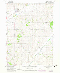
1969 Map of Danbury
USGS Topo · Published 1983About this map
Danbury sits as the primary settlement on this Woodbury County survey, positioned near the confluence of the Maple River and Koker Creek. The town's layout includes a central Park and reflects its religious and community history through the presence of St Marys Cem, St Patricks Cem, and Danbury Cem. Beyond the town limits, the landscape transitions into a network of drainage basins, with Heisler Creek and Rush Creek cutting through the terrain of Cooper and Garfield townships.
Find a feature on this map
23 named features on this map. Tap any name to fly to it.
Don’t see what you’re looking for? This feature index may not catch every label — zoom into the map to look around manually.
Map Details
Editions of this 1969 Danbury Map
2 editions found
Other maps of this area

1954 · Fort Dodge
USGS Topo · 1:250,000

1957 · Fort Dodge
USGS Topo · 1:250,000

1958 · Fort Dodge
USGS Topo · 1:250,000

1967 · Battle Creek
USGS Topo · 1:24,000

1969 · Danbury
USGS Topo · 1:24,000

1969 · Holstein SW
USGS Topo · 1:24,000

1969 · Mapleton
USGS Topo · 1:24,000
1969 · Correctionville SE
USGS Topo · 1:24,000
1971 · Mapleton SE
USGS Topo · 1:24,000

1971 · Ricketts
USGS Topo · 1:24,000