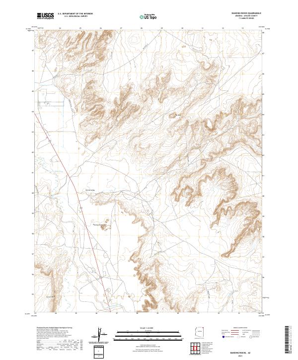
2021 Map of Dancing Rocks
USGS Topo · Published 2021About this map
Chinle Valley serves as the central geographic feature of this high-desert landscape in Apache County, where seasonal watercourses like Chinle Wash and Lukachukai Creek weave through the sandstone terrain. The map is defined by its striking rock formations, including the eponymous Dancing Rocks and the prominent Hat Rock located to the north. These landmarks provide essential orientation points in an area largely characterized by vast mesas and winding canyons, such as Carson Mesa in the southwest corner. The transport network is dictated by the land's contours, with Indian Rte 35 and Indian Rte 8009 providing the primary access across the valley floor. This 2021 edition reflects the contemporary topographic reality of this Navajo Nation territory, mapping the precise elevations of the ridgelines and the subtle drainages of Hasbidito Cr.
Find a feature on this map
18 named features on this map. Tap any name to fly to it.
Don’t see what you’re looking for? This feature index may not catch every label — zoom into the map to look around manually.
Map Details
Editions of this 2021 Dancing Rocks Map
This is the sole edition of this map. No revisions or reprints were ever made.
Other maps of this area

1892 · Canyon De Chelly
USGS Topo · 1:250,000

1953 · Los Gigantes NW
USGS Topo · 1:24,000

1953 · Dinne Mesa SW
USGS Topo · 1:24,000

1953 · Los Gigantes SW
USGS Topo · 1:24,000

1953 · Toh-Atin Mesa
USGS Topo · 1:62,500

1953 · Los Gigantes Buttes
USGS Topo · 1:62,500

1954 · Shiprock
USGS Topo · 1:250,000

1958 · Shiprock
USGS Topo · 1:250,000

1959 · Shiprock
USGS Topo · 1:250,000
1968 · Hogansaani Spring
USGS Topo · 1:24,000