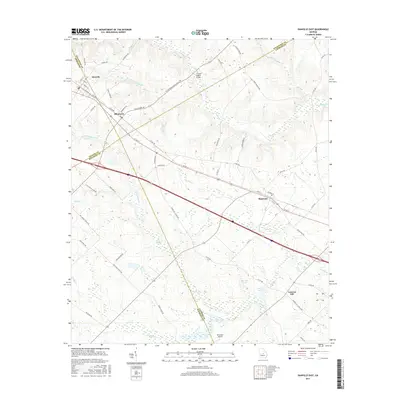
2017 Map of Danville East
USGS Topo · Published 2017About this map
Danville and Allentown anchor the northwest corner of this Georgia landscape, situated where the borders of Wilkinson, Twiggs, and Bleckley counties converge. The terrain is defined by a dense network of creek drainages, including Turkey Cr and Little Rocky Cr, which flow through the agricultural lands of the coastal plain. Further east, the community of Montrose sits along the primary transport corridor, while Laurens Hill marks the southeastern reaches of the survey area.
Find a feature on this map
68 named features on this map. Tap any name to fly to it.
Don’t see what you’re looking for? This feature index may not catch every label — zoom into the map to look around manually.
Map Details
Editions of this 2017 Danville East Map
This is the sole edition of this map. No revisions or reprints were ever made.
Other maps of this area

1956 · Cochran
USGS Topo · 1:62,500

1956 · Jeffersonville
USGS Topo · 1:62,500

1957 · Macon
USGS Topo · 1:250,000

1958 · Macon
USGS Topo · 1:250,000

1964 · Macon
USGS Topo · 1:250,000

1974 · Chester
USGS Topo · 1:24,000

1974 · Danville East
USGS Topo · 1:24,000

1974 · Dudley
USGS Topo · 1:24,000
1974 · Nicklesville
USGS Topo · 1:24,000
1974 · Stuckey Boone Lake
USGS Topo · 1:24,000