Loading...
Loading map...2022 Map of Darlington
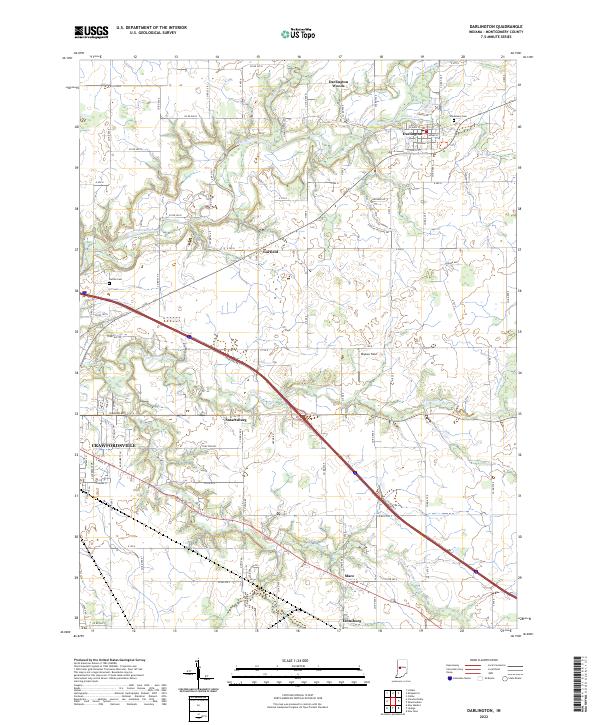
USGS Topo · Published 2022About this map
Sugar Creek winds through the northern landscape of Montgomery County, providing the primary drainage for the agricultural lands surrounding Darlington. The town is defined by a traditional street grid including W Main St and Adams St, sitting just south of the Darlington Woods. To the south, the terrain is crossed by the diagonal path of Interstate 74, which bisects the townships and passes near the small settlements of Smartsburg and Garfield.
Find a feature on this map
50 named features on this map. Tap any name to fly to it.
Don’t see what you’re looking for? This feature index may not catch every label — zoom into the map to look around manually.
Map Details
Date Portrayed2022
Date Published2022
PublisherU.S. Geological Survey
Map TypeTopographic
Scale1:24000
Physical Dimensions24 x 29 inches
Editions of this 2022 Darlington Map
This is the sole edition of this map. No revisions or reprints were ever made.
Historical Maps of Linnsburg Through Time
Featured Locations
Source Details
SourceU.S. Geological Survey
CopyrightPublic Domain