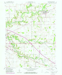
1958 Map of Darlington
USGS Topo · Published 1980About this map
Sugar Creek winds through the heart of Montgomery County, anchoring a landscape defined by small rural hubs and the agricultural legacy of Franklin, Union, and Walnut townships. In the late 1950s, the town of Darlington served as a central point for the local economy, featuring a cluster of storage bins and a prominent water tower near the Honey Creek confluence. Further south, the landscape transitions into a network of established crossroads like Smartsburg, Mace, and Linnsburg, the latter situated along the Conrail line. Of particular interest to local historians is the Old Railroad Grade north of town, which traces a previous transportation route. The area is dotted with community landmarks, including the Gravelly Run Ch, several burial grounds such as Greenlawn Cem and Hutton Cem, and the Township Sch, reflecting the tight-knit social fabric of these Indiana communities during the mid-twentieth century.
Find a feature on this map
25 named features on this map. Tap any name to fly to it.
Don’t see what you’re looking for? This feature index may not catch every label — zoom into the map to look around manually.
Map Details
Editions of this 1958 Darlington Map
2 editions found
Other maps of this area

1953 · Danville
USGS Topo · 1:250,000

1953 · Indianapolis
USGS Topo · 1:250,000

1955 · Danville
USGS Topo · 1:250,000

1956 · Danville
USGS Topo · 1:250,000

1956 · Indianapolis
USGS Topo · 1:250,000

1956 · Crawfordsville
USGS Topo · 1:24,000

1956 · New Market
USGS Topo · 1:24,000

1957 · Indianapolis
USGS Topo · 1:250,000

1957 · New Ross
USGS Topo · 1:24,000

1958 · Darlington
USGS Topo · 1:24,000